
UN Map Depicts Separate India-China Claim Lines for Arunachal Pradesh, Aksai Chin
India reiterates that its sovereign territory must be shown according to the country’s official map

By Anjali Sharma
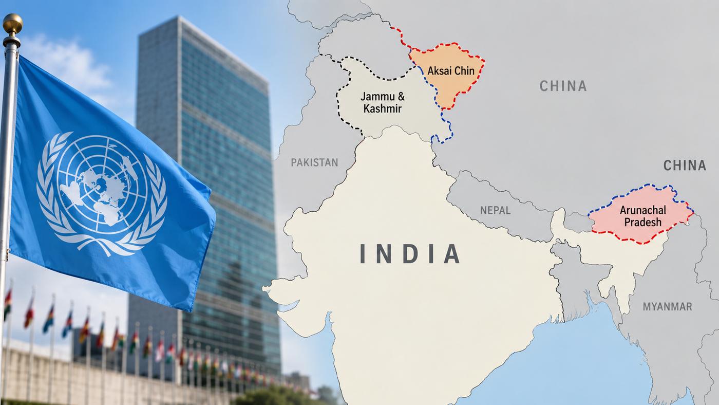
UNITED NATIONS- UN on Monday has drawn attention after it appears to have depicted Arunachal Pradesh and Aksai Chin with separate Indian and Chinese claim lines.
UN map depicts Jammu and Kashmir with a dotted line representing the Line of Control (LoC) between India and Pakistan, and includes an explanatory note for the LoC.
It was published on July 1, 2026, the UN map shows the southern boundary of Arunachal Pradesh with Assam as a “Chinese Line”, while eliminated the state’s boundary with Nagaland. Also, it shows ths state’s northern boundary with China’s Tibet marked as an “Indian Line,” media reported.
In case of Aksai Chin, which India officially considers part of Ladakh, the map marked the region’s eastern boundaries as an “Indian Line” and uses a “Chinese Line” that appears to serve as a line of demarcation between Ladakh from Aksai Chin, the report highlighted.
It depicts Jammu and Kashmir with a dotted line representing the Line of Control (LoC) between India and Pakistan, and includes an explanatory note for the LoC.
It stated that the “dotted line represents approximately the Line of Control agreed upon by India and Pakistan. The final status of Jammu and Kashmir has not been agreed upon by the two parties.”
It fails to mention any similar explanation accompanying the separate Indian and Chinese claim lines shown around Arunachal Pradesh and Aksai Chin.
The resolution, sponsored by Togo and supported by the African Union, seeks to promote more equitable representation in world maps.
It reiterated India’s support to the “Correct the Map” resolution, the Ministry of External Affairs had on Sunday, September 6, stated that “India voted in favor of the resolution” and explained its position as a vote on the “underlying principle of promoting equal – area cartographic representation.”
The ministry stressed that it did not amount to an endorsement of any specific map, projection or depiction of national boundaries.
“India’s sovereign territory, including the Union Territories of Jammu and Kashmir and Ladakh, must be depicted in accordance with India’s official map. Any inaccurate or misleading depiction is unacceptable,” MEA spokesperson Randhir Jaiswal said.
